
Story time! Sometime last year, I went to this
restaurant in Woburn with my fance food friends, and it was in the old Baldwin mansion. I of course wanted to know if they were connected to any of the Baldwins I knew (the brothers Baldwin, and the best Baldwin, James) but it turns out this Baldwin was a dude who fought with
George Washington in the Revolutionary war, and propagated an apple and was so into it that it was eventually called after him. During this wikipedia dive, I found out that Baldwin was also the first superintendent of the corporation which built the Middlesex Canal.
What the fuck is the Middlesex Canal, and why had Lizzie and I, the brilliant historians that we are, as evidenced by this blog, never heard of it? We went to the Middlesex Canal Museum to find out more.
The museum is in Billerica, by the Concord River, which served as the main water source for the canal. (Horn Pond in the Wu was an ancillary source). That dam in the first picture has existed in some form since the 1600s. I made a dam pun to the fabulous volunteer staffing the museum, Neil, but he ignored it. This was our first indication that Neil was a smart man.
Post Revolutionary war, it was evident that a more efficient means of obtaining raw materials and shipping goods was needed, and the roads were either shit or non-existent, so a bunch of business bros were like "yo let's build a canal," and business bro #1 John Hancock was governor at the time, and they formed a corporation that sold private shares to finance it. In a who's who of the revolutionary set, shareholders included ol' big signature himself, John Hancock, eventual Prezzes John Adams & John Quincy Adams, James Sullivan (of Sullivan Sq fame) and of course our apple bro Loammi Baldwin. They broke ground in September of 1794, and all 27 miles of the canal, from Charlestown to East Chelmsford, were hand dug over the course of ten years.
The canal itself was generally only 3.5 feet deep, and in a practice called "not crossing streams" so they could control the level of the water, the canal didn't connect with any of the other water ways nearby, so they had to build aqueducts (8 total) to ensure smooth sailing over rivers like the Shawsheen and the Merrimack (parts of the giant aqueduct over the Shawsheen still exists). There was some sweet lock action, too, to deal with changes in height in relation to sea-level.
FUN FACTS:
Passage on the canal was not allowed at night, so there were taverns built, including the "Horn Pond House," by, you got it, Horn Pond, and Horn Pond itself had a little island on it that housed a dance hall and a bowling alley. Woburn as always brought the party.
Musquash, aka Muskrats, and other similar animals would eat the sides of the canal, so people were paid to kill them and bring in their little dead bodies. RIP Musquash :(
Eventually there was a canal built which connected the Charlestown mill ponds to the Boston Harbor, which, at the time, was located by Faneuil Hall. Guess what there's a street there now called
CANAL STREET.
The canal shut down in 1853. Railroads came along and were like "lol we operate in the winter how about you?" and the canal was like ":( no" and it quickly fell into disrepair. Bridges were ripped down, and the canal filled in in parts. Parts of it are under the Mystic Valley Parkway, and Boston Ave in Medford crosses the Mystic River where the canal did, but parts of it are still visible and walkable, including a stretch by the aforementioned Baldwin Mansion (which was moved across Rte 38 bc the original location was made into a parking lot, natch). The shareholders lost their money and the canal WAS PROMPTLY FORGOTTEN.
Anyway, if you have a chance, go check out the
museum. Hopefully Neil will be on duty, because he was super knowledgeable, and had all the hot canal goss. Plus there are EXCELLENT displays. 10/10 would recommend for Neil + Dioramas. Lizzie bought me a sweet canal mug and xmas ornament, so if you want to come over my house and look at those, maybe I will let you...


 Story time! Sometime last year, I went to this restaurant in Woburn with my fance food friends, and it was in the old Baldwin mansion. I of course wanted to know if they were connected to any of the Baldwins I knew (the brothers Baldwin, and the best Baldwin, James) but it turns out this Baldwin was a dude who fought with George Washington in the Revolutionary war, and propagated an apple and was so into it that it was eventually called after him. During this wikipedia dive, I found out that Baldwin was also the first superintendent of the corporation which built the Middlesex Canal.


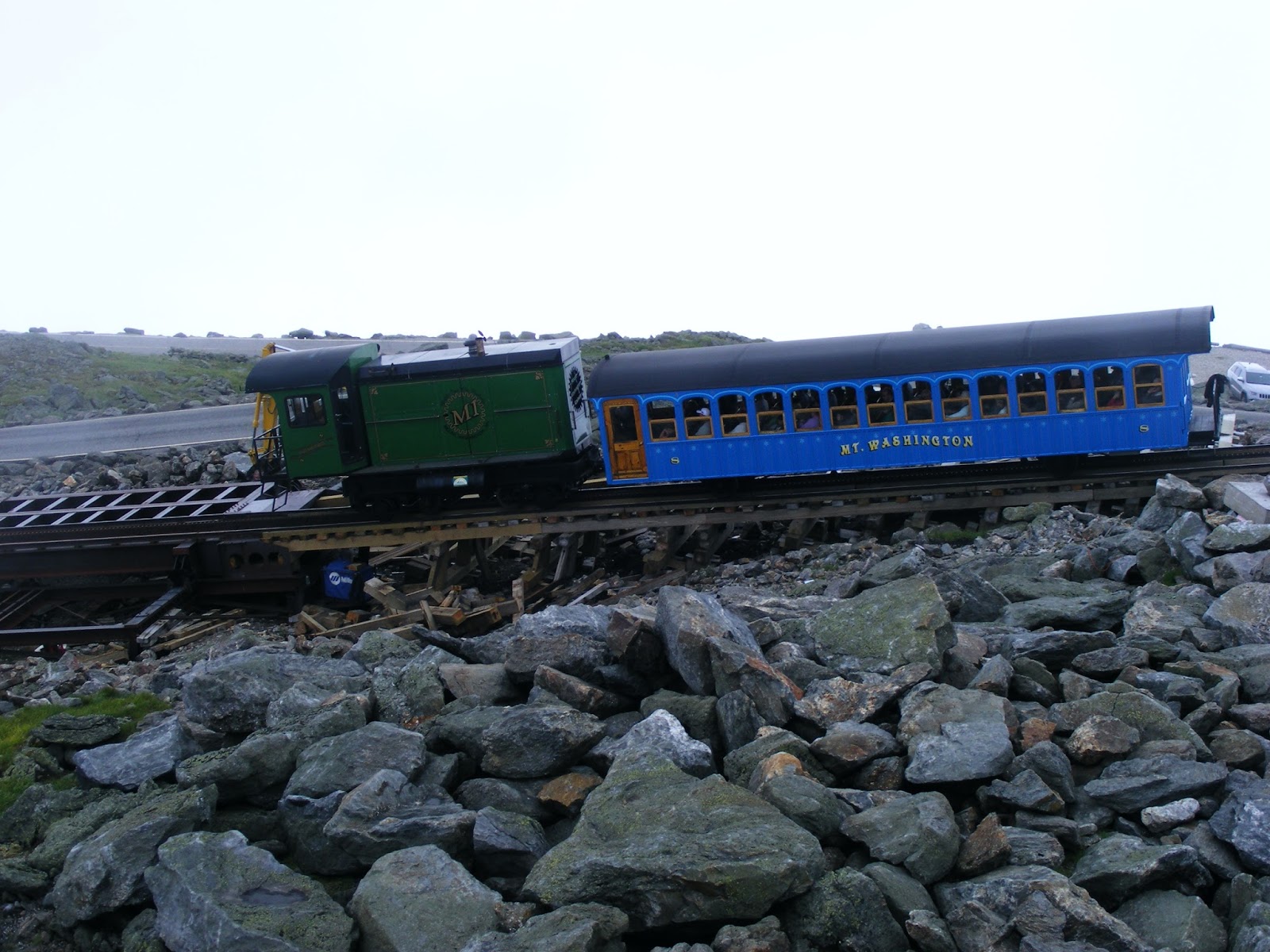 This cog railway, our brakeman told us, is the oldest in the US, and for a while, was the steepest at one point until the Swiss ruined it, like they ruin everything. There's a coal driven train that goes up, but ours was bio-diesel, and therefore didn't have to stop midway up to waste thousands of gallons of water to make that steam business happen. Yay! Also, back in the day, workers at the top would ride slideboards they'd invented down the railway which they named "Devil's Shingles" which probably was an indication that it wasn't the best idea, as flying down a mountain at 62mph on a piece of wood maybe isn't super safe, and the slideboards were banned after an employee died in 1906. Buzzkill. Anyway, it's about a 45 minute slow ride up to the summit.


 So mine and Lizzie's real goal in Clinton, MA was finding this abandoned train tunnel. When the Nashua River was dammed off, the original train tracks were flooded, and so this tunnel was built in 1903 for the Central Mass Railroad. At the time, it was the second biggest tunnel in the state, at a whopping .2 miles. Just 50 years later, the tracks had been ripped up, and this tunnel abandoned by the state.
 We hadn't originally planned to walk its entirety, but when we could easily see the, well, light at the end of the tunnel, we decided to pass all the way through, though we knew the tunnel was supposedly haunted, and that a young girl had been found dead here 40 years ago. After all, it was early afternoon, and we had hours of light left, and the tunnel was so short.
  But we had to go back through to get out. Had hours passed? We reentered the tunnel, following the non-existent tracks back (though somehow, they've appeared in this picture--the ground is rocky, full of crumbling stones, but there are no actual tracks), toward the eerie light, through the dripping ceiling, shivering as the ambient temperature dropped degree after degree. When we got to the center of the tunnel, it was so cold that we could see our breath--it hadn't felt like that on the initial pass. Noses running, hands freezing up like they do after a first, damp, snow, we stopped for a minute, feeling a strange thrumming in our chests, as if an actual train were passing by. We heard the low rumbling, thum-thum-thum-thum, and nervously mumbled about the magic of physics before picking up the pace. Again, the compact tunnel somehow stretched on for miles in both directions--we'd look back at the exit behind us, to the exit in front of us, both light, and beckoning, and still felt trapped in a never-ending purgatory of freezing darkness, with the bass of a passing train vibrating around us. Our echoing footsteps seemed to be in vain, as the exit's light loomed in front of us, somehow staying the same distance away as we moved in what we thought was a forward direction.


 We went up to 4200 feet here at Johnston Ridge, which directly faces the crater. Mt St Helen's was pretty chill today, but evidence of her destructive past was etched into the hillsides, and evident in the old forest trees which were blasted from their stumps. Parts of the mountain, now called hummocks, litter the valley. I went up to the top of the observatory, and when I came back down, Lizzie was listening to a lecture by a forest ranger, who began his spiel by shooting a chipmunk in the face with a green squirt gun he kept just for that purpose. The chipmunks here are very large, squirrel sized, and aggressive, and will have their revenge.


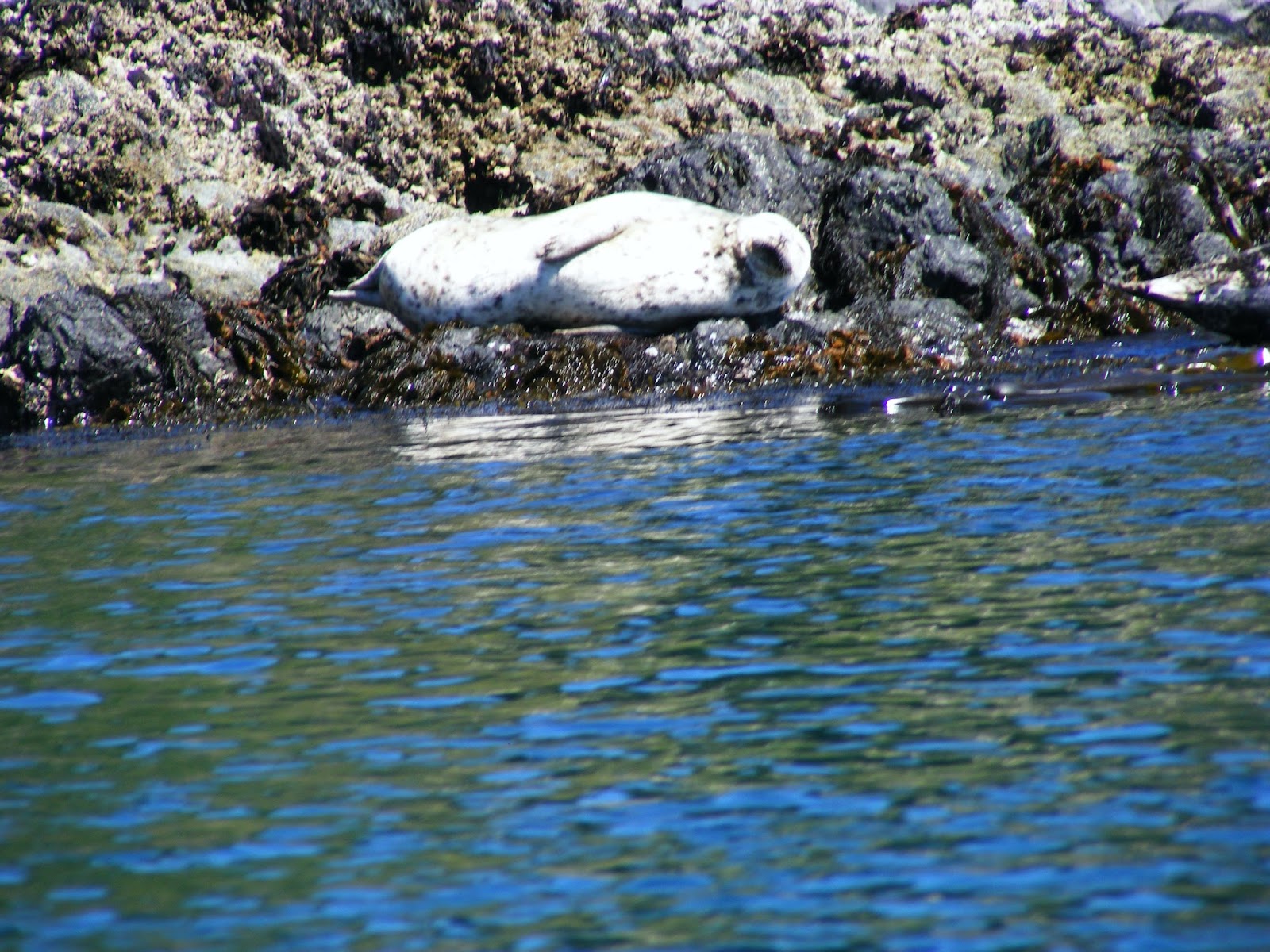
 Lizzie and I are maybe not in the best shape, but we hauled and were mostly able to keep up. We only stopped a few times to stare at the seals, one pictured below, but unfortunately on this part of the trip we did not see any orcas. Aside from the seals, we saw a dog which I mistakenly thought was a deer for a minute, a couple of crows, a sparrow chasing a butterfly (the butterfly won), a few geese and a seagull. Also, at one point, William took of his shirt and we were like "we are Nanas, please put that back on," but he had taken it off to show us kayak rolls. We declined to try it ourselves, as did the rest of our group.
 When we returned to the launch, we had to give our boats a sponge bath and haul them up to the shore, but I need to work on my guns, because Lizzie had to ask William to help me with my end of the boat. I AM A FAILURE. Also, I didn't have proper footwear, so I was windmilling on this slippery rock, trying to get my balance, and Lizzie had to shove me in the back to prevent disaster. That tricksy center of gravity...


